


Plociczna river
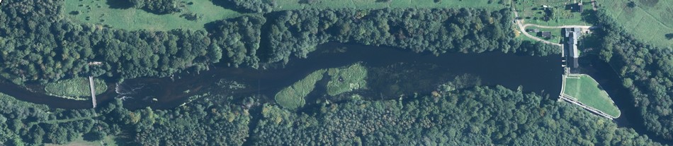
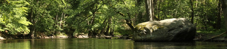
 A left-bank tributary of Drawa, about 51km long, and with a river-basin area of 440km². It begins near Mirosławiec. All the way to the estuary of River Runica, Płociczna is stabilized, narrow, and shallow; then it becomes wild, of an almost natural character. It runs through the lakes: Sitno, Płociczno, and Ostrowiec. The most beautiful part of the river (numerous meanders and precipices) is the region below its source at Lake Ostrowiec. Płociczna has an unusually changing character: stretches of rapid, wild current and gravel bottom are interwoven with calm fragments tat run through meadows and alder marshes. The river brings to the DNP the average of 1,2m³ of water per second. By Pustelnia it is already 2m³, and by its estuary to Drawa – 3m³. The water level remains stable throughout the year, varying only by up to 30cm.
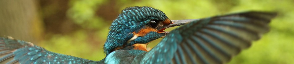
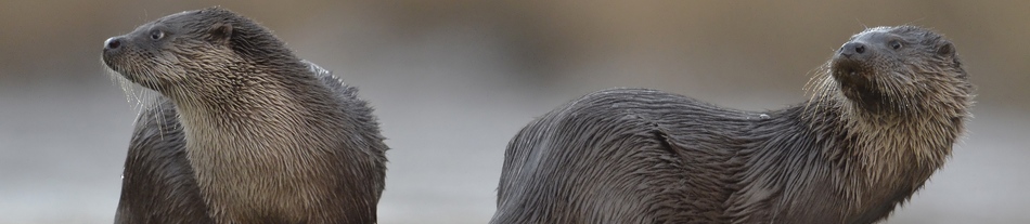
The valley has numerous leakages of underground water that are overgrown with alder forest. In some patches there are swamps with the presence of sunningdale. The river is home to roach, ruff, chub, loach, oerch, barbel, burbot, and other fish. Also fairly popular here are: brook trout, greyling, and white-finned gudgeon. There is a chance that some places in the river might potentially be used for salmon sprawning. The river is richly inhabited by beavers that cut the near-bank aspens and peel the bark off beeches. Otters also frequently station here. In Płociczna, especially in the stretch Sitno – Płociczno, rocks and boulders are overgrown with the red seaweed Hildebrandtia rivularis. The presence of this red seaweed is tightly connected to the specificity of its water biotope – with the rapid and tempestuous current (characteristic to Płociczna) as a crucial condition for its existence.
The level of water purity in Płociczna, especially in the stretch within the national park borders, by most of the physical and chemical standards, roughly meets the criteria for 1st class. This is rare on the national scale. Only the presence of phosphates (from municipal and agricultural sewage) and chlorophyll (a natural process of lifting plankton out of the lakes by the river current) prevents Płociczna from meeting the 1st class of purity standards.
The river has often been mentioned in old documents. From the 14th to 18th century its one long stretch constituted for a border between Brandenburgh and Wielkopolska (presently a border between the provinces Lubuskie and Wielkopolskie).
Marked tourist trails run through some stretches of Płociczna’s valley. One of them leads to the most beautiful parts of the valley, where we can see the ruins of an old mill, called Stara Węgornia